The waterfall walk
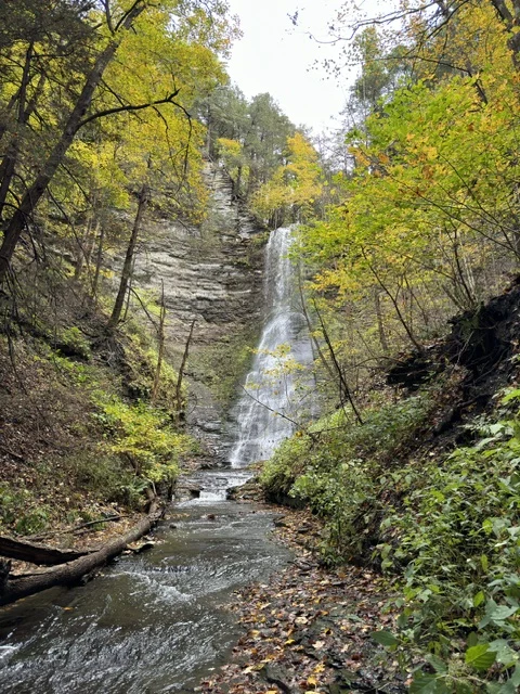
Access to the falls involves a creek hike and uneven terrain. Water flow and footing vary with weather and season. Arrange a guided property visit to understand the route; this is not an accessible paved walk.
A BRISTOL WATERFALL RETREAT · FINGER LAKES, NY
4861 State Route 64 and the adjoining Reed Gully waterfall land. Approximately 10 acres in the Bristol Hills.
The residence and adjoining waterfall land are offered together, with simultaneous closings.
Home: $499,900 · Waterfall land: $299,900.
Confirm current pricing and terms with Mark.
4861 State Route 64 + 6745 Fisher Tract Drive, Bristol, NY. Prices reflect the published listings checked November 9, 2026; subject to change. Acreage and dimensions approximate, subject to survey. *Tax and rental records describe bedroom spaces differently; verify the legal count and approved occupancy.
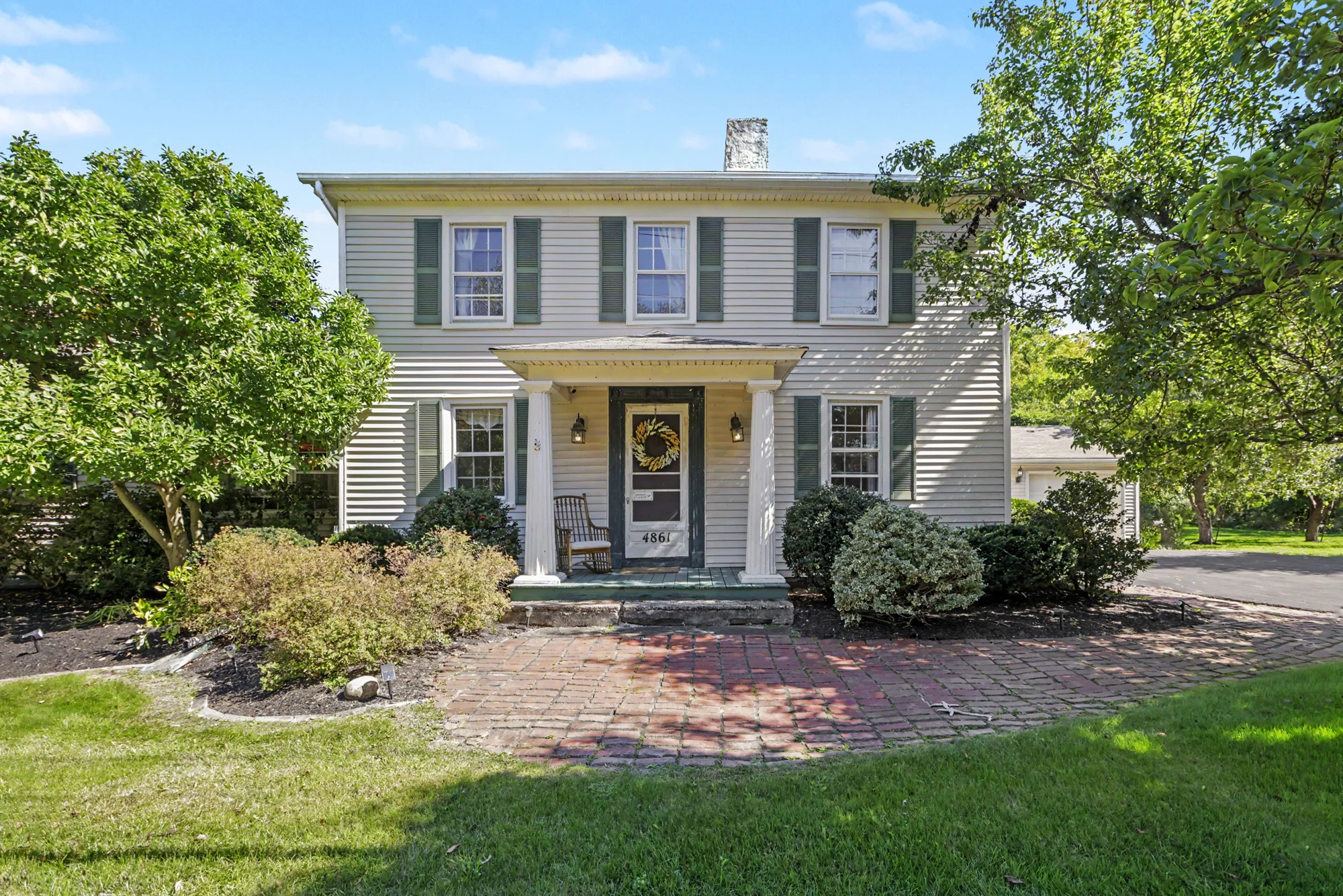 THE HOME / 4861 STATE ROUTE 64
ROOM TO SLOW DOWN
Hardwood floors and natural woodwork, a country kitchen with double ovens, a formal dining room and two main-level bedrooms. The layout also includes first-floor laundry, two mudrooms and a partially finished basement.
An enclosed rear porch with hot tub, a covered deck, a detached two-car garage with shop space and an existing pickleball court extend the living space outdoors.
Reported listing features. Ask Mark for disclosures, current bills and inspection records.
The two properties are separately listed and intended to close simultaneously. Furnishings may be negotiable; confirm inclusions in writing. The tax report lists three bedrooms, the MLS lists four, and the rental listing describes five sleeping rooms. Verify permitted occupancy, system condition and the current tax bills. No rental income or expansion approval is guaranteed.
Explore the layout across three levels. Enlarge each plan for room labels and approximate dimensions.
Illustrative floor plans, not architectural drawings. Dimensions and room labels are approximate and do not establish legal bedroom count or approved occupancy.
Explore the home in 3D ↗Listing photography and owner-supplied seasonal photographs.
The fixed outline includes the narrow Fisher Tract connection. Mapped streams and terrain contours explain the relationship between the home and the back land.
Access to the falls involves a creek hike and uneven terrain. Water flow and footing vary with weather and season. Arrange a guided property visit to understand the route; this is not an accessible paved walk.
The included strip appears in the supplied parcel outline. A new vehicle road is a separate concept requiring title, grade, drainage and municipal review.
Boundary traced from the broker-supplied county tax map, with Ontario County mapped streams and USGS 3DEP terrain registered to it. Illustrative mapping, not a boundary or engineering survey. The waterfall and owner-reported existing yurt pad have not been given invented coordinates.
Open the original tax map ↗Owner photographs show changing water flow, autumn color and winter ice.
Photographs supplied by the owner. Water flow, ice and access conditions vary by season.
AN EXISTING SHORT-TERM RENTAL
A current short-term rental with published guest reviews.
Reed Gully is part of an existing Airbnb offering hosted by Greg, with Courtney as co-host. The home, hot tub, pickleball court and woodland setting create a stay built around time together.
For a buyer, that operating history offers a starting point: enjoy the property personally, investigate continuing the rental, or explore a more focused hospitality concept.
See the Airbnb listing & reviews ↗“Our families loved playing pickleball and hiking to the waterfall.”
Morgan W. · September 2025
Ratings describe the current listing and hosting experience; listing accounts, reviews, reservations and host status are not promised to transfer with a sale. Bedroom counts differ: the current tax report lists three, the MLS lists four, and Airbnb markets five sleeping rooms. Buyers should verify the legal bedroom count, approved occupancy and all operating requirements.
Review historical statements, booking records, expenses and the owner’s planning assumptions with Mark. Future revenue, rental continuity and expanded uses require separate verification.
Three visual studies explore the owner’s retreat idea. These AI-generated scenes and schematic layouts illustrate possibilities, not approved uses, surveyed locations or development capacity.
Permitted uses, current boundary/topographic survey, title and access rights, stream and flood constraints, slopes, utilities, septic capacity, parking and emergency access. Buildings, roads, events and overnight occupancy require applicable approvals. No construction cost, yield or future revenue is represented.
Town of Bristol zoning code ↗Ski days. Wine trails. Lake afternoons.
Find your kind of Finger Lakes.
Drive times and road mileage are estimates from OpenStreetMap/OSRM routes checked November 9, 2026. Times are rounded up to whole minutes, exclude live traffic and may vary with weather or route. Use Directions for current routing. Venue pins are approximate; this map does not depict property boundaries.
Venues link to their official visitor information. Coordinates use official maps or address geocoding. Drive estimates use an OpenStreetMap/OSRM road-network calculation, not live traffic. Hazlitt and Grimes Glen have directions links without unverified map pins.
Arrange a showing, discuss the paired purchase or request the owner’s operating records.
Private property. Visits and waterfall access by appointment only.
Download the property brochure ↓